The ‘Light pollution group’ at Truman State University has been involved in quantifying the sky brightness in the Kirksville area for over three years, starting in 2016. The objectives of our work are summarized below:
- Quantify the sky brightness at various locations using Sky Quality Meters (SQM) sensors
- Create awareness within the community about
a) inefficient and harmful light fixtures and ‘bad’ outdoor lighting habits
b) the financial, environmental, and health benefits of ‘smart’ outdoor lighting. - Actions
a) Installation of ‘warm’ LED lights and retrofitted dark-sky friendly shields on existing ‘unfriendly’ fixtures in coordination with university and city officials
b) Continuous monitoring of sky brightness at various locations in and around Kirksville to quantify the efficacy of ‘warm’ lights and light shields
c) Collaborate with city, state, and national parks to maintain the beauty of the night sky
Quantifying Light Pollution
We use ‘Sky Quality Meters’ manufactured by Unihedron to measure the sky brightness at various locations. We have partnered with the Missouri Chapter of the International Dark Sky Association to set up SQMs at 10 different locations across the state of Missouri. These locations are:
- Broemmelsiek Park, Defiance, MO (Z2)
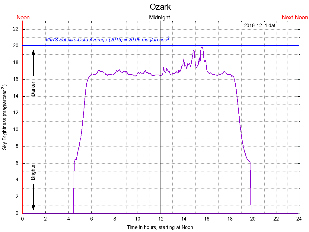
- City of Ozark, MO (Z4)
- City of Perryville, MO (Z3)
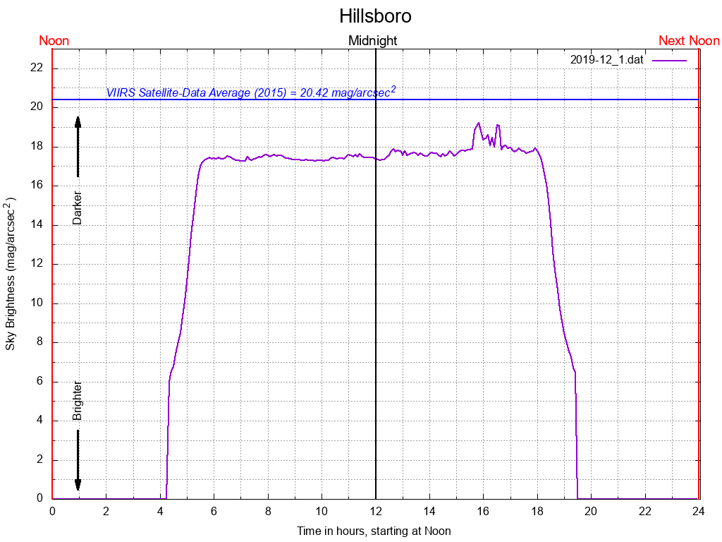
- Jefferson College, Hillsboro, MO (Z2)
- Laws Observatory, Columbia, MO (Z6)
- Magruder Hall, Kirksville, MO (Z1)
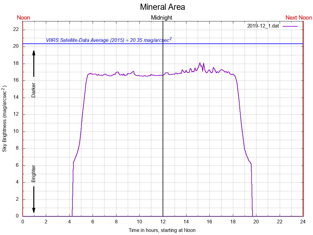
- Mineral Area College, Park Hills, MO (Z3)
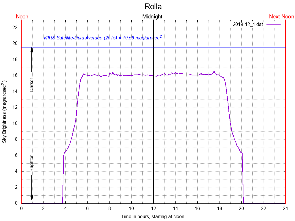
- S&T Astronomical Society, Rolla, MO (Z3)
- Southeast Missouri State University, Cape Girardeau, MO (Z3)
- Truman State Observatory, Kirksville, MO (Z1)
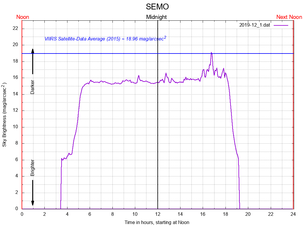
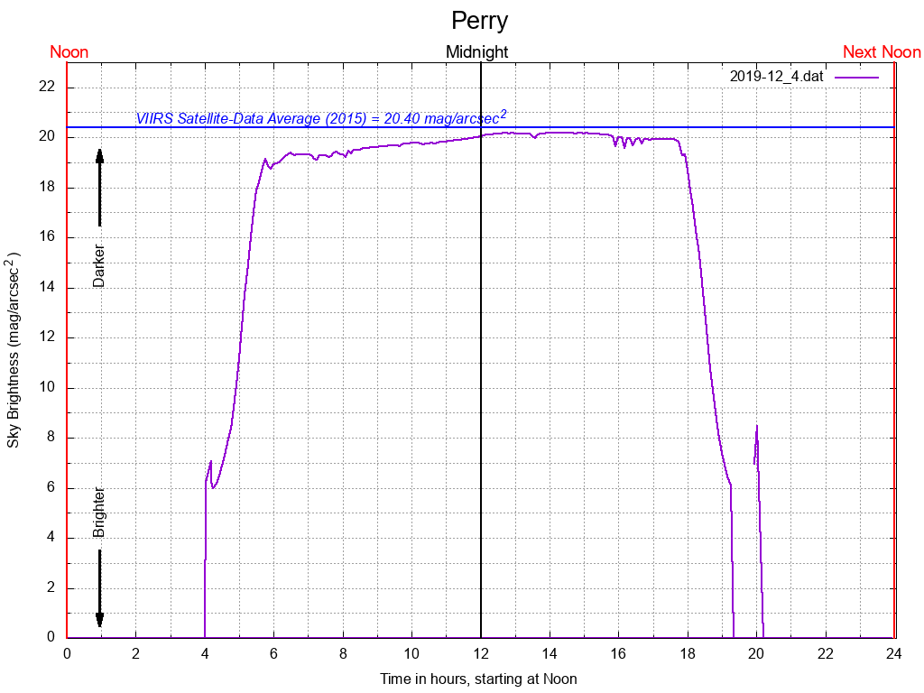
Here are some examples of plots using the data obtained from our SQM stations across the state. Each plot below is from the last week of December 2019, December 25th being a new moon. The y-axis in the plot represents the sky brightness (measured in mag/arcsec2) — the higher the number, the darker the sky. The darkest, reliable sky measurements using SQMs are about 22 mag/arcsec2. The x-axis is essentially time in hours. Since we are interested in data for a given night, we have scaled the time axis to begin at noon of one day, and end at noon the next day. Hence “12” on the x-axis is midnight. Superposed (in blue) on each plot is the average measurement made by the VIIRS satellite. Please see https://www.lightpollutionmap.info/ where you can find a world map with sky brightness measurements made by various satellites. You can easily zoom in to your town or even your house and click. A box with the sky brightness measurements, if any, and the calculated sky brightness from satellite measurements will pop up.
Clicking on the graph opens up an animation — it consists of plots from December 2019 for that location. My students and i are processing these images and correlating these data with local weather conditions such as humidity and cloud cover. In addition, we take into account the moon phase. The research questions we are trying to answer is:
“How do the local weather conditions affect the Sky Brightness as measured by the SQMs?”
MARAC Talk powerpoint: This is a powerpoint presentation (with additional slides) of a talk at the